| GPS performance Receiver: | Built-in high sensitivity GPS chip |
| antenna: | built-in GPS antenna |
| positioning accuracy of 1: | 3 to 5 meters (2D RMS) |
| SBAS 1 to 3 meters (2D RMS) |
| single point positioning verticalpositioning <3 m high (barometric) |
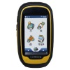
| display screen features: | 3 inches (39.24mmx65.4mm) TFT color touch screen |
| resolution: | 240 × 400 pixel, backlit |
| operator panel: | Touch screen, 3 function keys, |
| power source characteristics, | |
| working hours | Use 2 AA Ni-MH batterycan work more than 15 hours (typical) using two AA alkaline batteries can work more than 12 hours (typical) |
| :Support Mini USB Power Supply to support the car charger (with optional attachments) |
| electronic map of maps and collection functions: | NavInfonew authority of the genuine map data, |
| data collection: | support for waypoints, routes, track collection |
| area measurement: | Support route, track area |
| Data communication and storage data communication: |
Bluetooth V2.0, support EDRMini USB 2.0 |
| data transmission storage: | 4GB, support a Micro SD, SDHC expansion up to 32GB |
| Waypoints: | support up to 2000 stored number can be displayed on the map |
| Routes: | the number of support storage of up to 50 per route passenger add 2-100 destinations |
| Track: | the number of support storage depends on the remaining memory capacity on the map can support up to display 10, the temporary track up to 10 000 points of physical indicators |
| Size: | 121.0mm × 68.7mm × 37.0mm (length × width × thickness) |
| Weight: | 184g ± 5g |
| Environmental Characteristics | |
| Operating Temperature: | -10 °C ~ +60 °C |
| Storage temperature: | -20 °C ~ +70 ° C |
| dustproof and waterproof: | IP67 |
| earthquake: | 1 m naturally fell to the ground |
| advanced features | three-axis electronic compass, barometric altimeter 320 Millionpixel zoom camera |
| audio function | built-in speakers along the navigation live voice broadcast |
| Utility tools | travel calculator, calendar, sun and moon, astronomical, calculator1. actual positioning accuracy and satellite status, the quality of the differential signal and the field work environment 2. based on the enhanced systemsatellites, including, as appropriate to the North American WAAS, Europe the EGNOS, Japan MSAS 3. The requested selection of high quality battery, otherwise the working hours may be will to some extent, to shorten the definition of 4. typical operating the GPS in a stable tracking status, user interface more than 75% of time innavigation, data acquisition, ephemeris page, the screen brightness to suit the field work, keypad tones, the keyboard lights off, the track record of open |